Drone photography is a relatively newer concept introduced to real estate photography and that has instantly made its mark. Its ability to show the property from a bird’s eye view raises its importance as realtors can show the property’s comprehensive outlook. As the tool becomes more advanced, real estate drone photography pricing is also becoming more affordable.
The ability to show a property from an aerial view has massively increased the persuasion and conversion rate for the real estate firms. For example, a study under MLS statistics claimed that property listings with drone footage or aerial images sold 68% faster than homes with standard images.
Drones are available in a wide variety and choosing the one that fits the user can be challenging.
Page Contents
Factors That Affect Drone Photography Pricing
Drone photography differs based on different factors. Drone photography’s ability to take aerial photos from various angles requires considering a range of processes and elements. These factors and conditions determine the cost incurred while producing complete drone photography. In-depth, these are some prominent factors that affect photography prices:
The size of the property
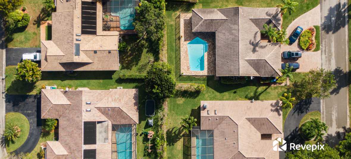
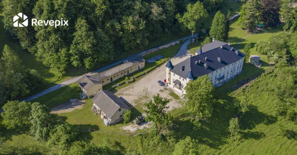
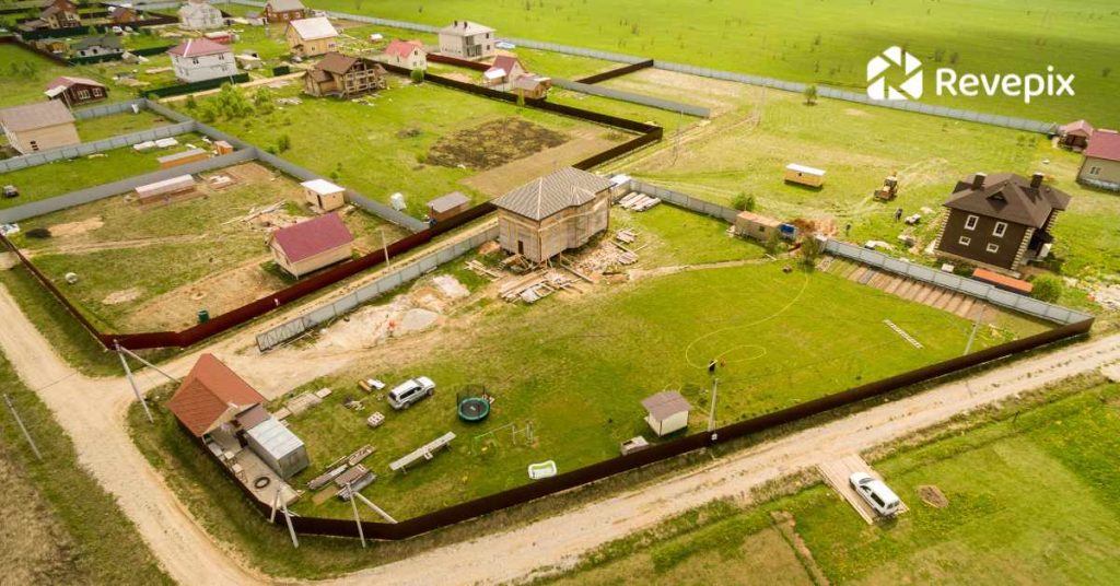
The area mass that needs to be covered by drone photography is the first factor that decides the pricing. The core idea behind drone photography is to cover maximum range of the property’s exteriors, its surrounding, and neighborhood. For a comprehensive outlook of the property, its size will determine the cost of drone photography. For instance, a huge mansion’s drone photography will come costlier compared to a small house.
Location
Flying a drone is not an easy task at all, especially with strict rules and regulations disallowing them to fly over certain zones. The location of which the aerial shot is required will have a proportional effect on the price. Firstly due to the complications and risk factor as it might have, secondly, also because of difficult locations. Not all locations are ideal to take drone footage. Taking drone shots under difficult locations might be costlier.
The complexity of the shoot
Drone shots require operating drone devices and flying them in different ways to capture the property’s different angles. Some of the best photography shots are captured from the most difficult places, and it’s no different with drones. The complexity of the shoot may also be charged higher.
Post-processing & editing
People stereotypically believe stunning pictures are due to photographers taking pictures from amazing angles. In reality, quality images require an equal amount of detailed editing. Post-processing and editing brings the best out of visuals collected by drones. This is more of a compulsion for quality final product but comes as an additional cost.
Type of Drone
There are a variety of drones out there with all of them having their own specific features. While some are high-tech, some are not. The best drone gadgets are expensive but also produce the best quality of images. These advanced drones have strong flying ability and highly sophisticated lenses. The quality of drone used will also vary on its costs.
Drone Pilot Experience
Operating drones requires skills and expertise. Although there are some tools in the market that anybody can easily operate, only experts can make advanced usage of it. The profile of the drone pilot and the experience they carry will also determine the cost for real estate drone photography pricing.
Standard Pricing for Real Estate Drone Photography Services
The cost of drone photography is determined by different factors, such as the photographer’s experience, equipment, project location, and project objectives.
In Los Angeles, a tentative figure for real estate drone photography is between $70 to $250 per hour. But again, it is only an average range, and the actual cost depends upon the industry and the work’s nature.
Real estate industries are one of the prominent users of drone photography. As the industry slowly realizes the importance of presenting persuasive pictures of the property online, the demand for drone photography in real estate has increased and affected real estate drone photography pricing.
Around LA, the average pricing of real estate drone photography can range between $100-$150/hr, and the price may vary for an extensive package (e.g., including drone shots or video).
Real estate drone photography comes with either an hourly charge or a fixed price. For real estate photography, rates may range from $50 to $400 per project, typically including a flyover of the property and a short video.
However, normal drone photographers may offer a flat fee of around $150 for their services, such as a basic aerial overview without editing. You can view different features along with its price and packages to choose the one that befits your need.
To get an in-depth understanding, visit our article: how much does a drone shoot cost?
Tips for Hiring a Real Estate Drone Photographer
Hiring a drone professional is based on the customer’s desires and needs. Users have different sets of expectations. Fulfilling such variety of ideas requires an expert drone photographer with relevant experience. Real estate drone photography pricing might significantly decrease in one’s favor if they have basic knowledge and tips about it. Here are a few tips before hiring a drone photographer that can be helpful:
- Licensed and insured
Flying drones requires its own license. Ensure the drone photographer complies with the Federal Aviation Administration’s Rules and Guidelines. For instance, Part 107 licenses for commercial drone services is a section about drones under 55 pounds since 2016.
Having such licensed drone photographers will ensure the footages are legally sound; however, not having a licensed photographer may instead lead to the footage being confiscated by authorities.
In addition, it is also beneficial to have the operator insured in case an unfortunate situation rises.
- Airspace Permit
Drones have been a complicated subject because they operate in the air. It is highly important that the flight of drones does not affect or interfere air traffic in any way or shape or form. Such cases could lead to major consequences. There are also other sites that are prohibited to enter without permission, specially military airspace. It is crucial to make sure that the drones will fly in allowed spaces and has a special permission in place before flying into complex zones.
- Drone Skills
Drone is actually technological tool. Operating might be easy for all but using it professionally is a whole another topic. Only skilled drone operators can make productive use of drones. Its better to look out for photographers who have drone experience and skillset.
- Personalization
Your expectations and wants might be different. The output of drone photography is based on drone photographer so it is important to let the photographer know your desired results. And it is equally important to know if the photographer has relevant experience in the way you want.
Conclusion
Determining the right drone photography depends upon a variety of factors. Once there is clarity with the objectives of hiring a drone photographer, there are other different areas that need to be reassured like the size of the property, the complexity of shoot, the operator’s quality, etc. These all factors make up the real estate drone photography pricing. Additionally, there are a few background elements that any customer or drone photographer could make the process smooth, safe and efficient.
The process of selecting the right drone photography for your firm might become hectic. We at Revepix provide our customers with premium and comprehensive drone photography service.
Also, check out our guide on real estate photography pricing to discover the distinctions between real estate photography and real estate drone photography.
FAQs of Real Estate Drone Photography Pricing
In a digital era where most real estate market is online, having persuasive property pictures to show does have a huge impact. Prospective buyers would see the property’s comprehensive layout, neighbourhood and outdoors, increasing the chance of buying it.
An average market fee for a normal drone photography around LA is approximately $100-$150/h. The fees can be either charged on an hourly basis or with a total flat fee. The average flat fee is around $150.
Early morning or evening would be perfect for real estate drone photography. During these hours, the light is softer and more atmospheric, as the low sunlight will cast shadows on objects that look amazingly good from a bird’s eye view.
The process of producing a drone photography begins with flying the drone into position, then you shoot the first image and proceed to complete the vertical panorama. The file is then imported and processed. Then the file is refined, and the settings are synced before exporting, merging, and cropping.
The price of drone real estate photography services can either be charged on hourly basis or a in the form of a flat fee for the whole project.
Generally, it takes around 24 to 48 hours to produce a complete real estate photo. However, it will completely depend upon the nature of the project as some may take more while some take less.